Ronald Reagan Airport (DCA)
General information Reagan Airport
Country: United States (USA)
ISO code country: US
City: Arlington
Airport name: Ronald Reagan Washington National Airport
Code IATA: DCA
Code ICAO: KDCA
Time zone: -5.0 GMT
Altitude: 5 meters
Length of runway: 2185 meters
Fast navigation
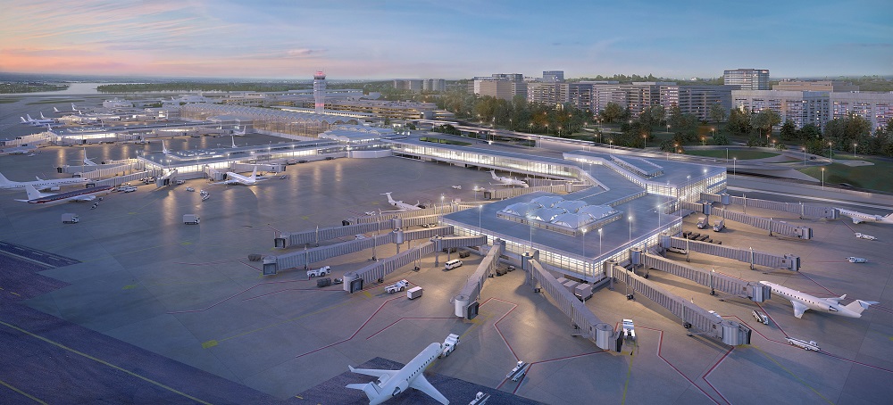
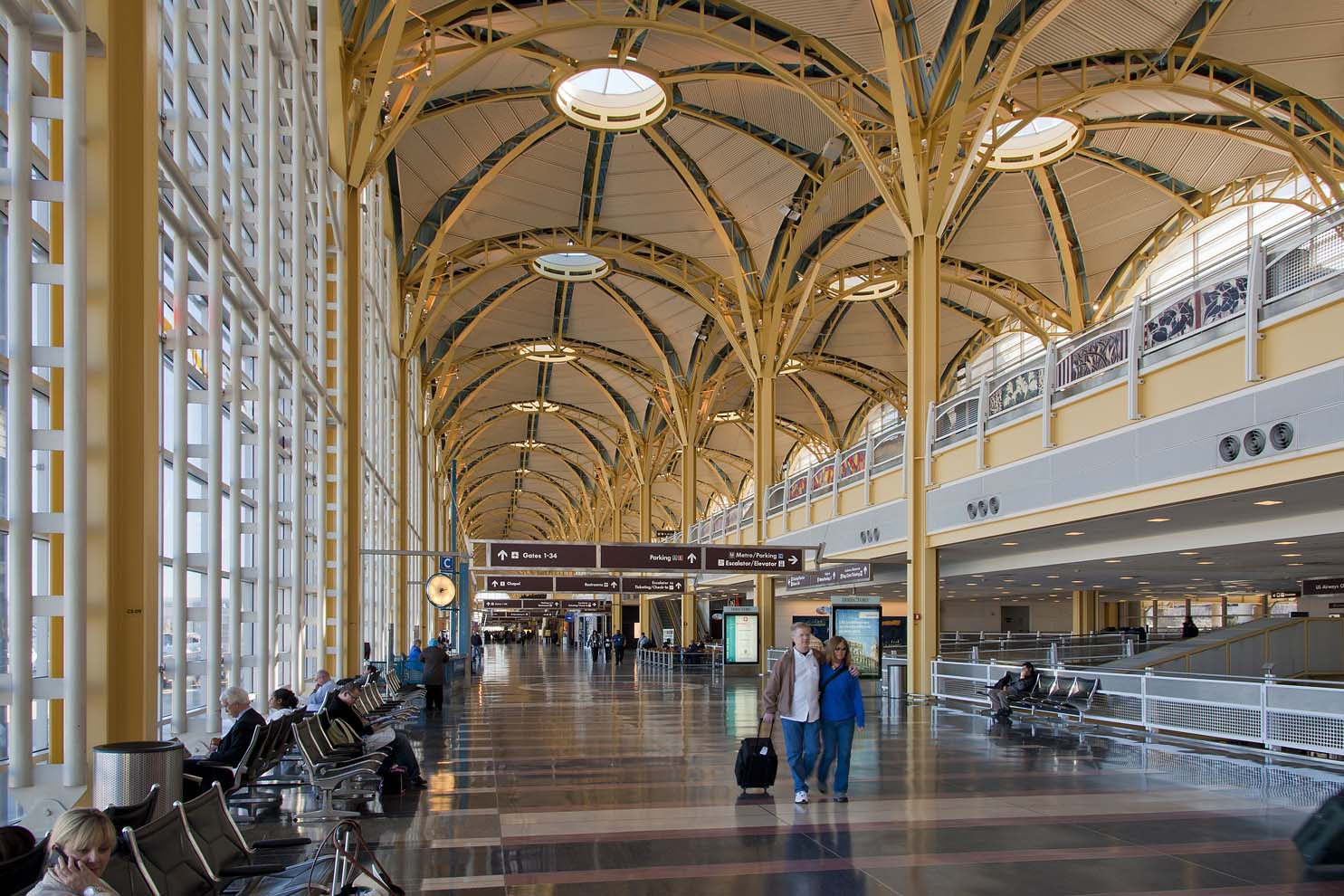
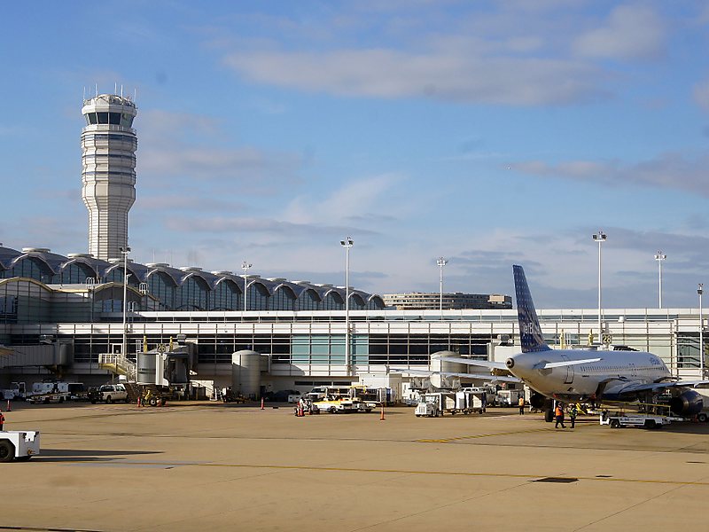
Photo Reagan airport
Ronald Reagan airport contacts: adress, zip code, phone
Tel: +1 703-417-8000
Adress: Arlington, VA 22202, USA
Web: flyreagan.com
Reagan (DCA) airport on map — location
General info about Ronald Reagan National Airport
Ronald Reagan Washington National Airport, popularly called Reagan National Airport, Washington National, or, more simply, Reagan Airport or National Airport, is the smaller of two commercial airports operated by the Metropolitan Washington Airports Authority that serve the National Capital Region (NCR) around Washington, D.C., the larger airport being Washington Dulles International Airport approximately 30 miles to the west in Virginia’s Fairfax and Loudoun counties. Located on the west bank of the Potomac River just to the south of the 14th Street/I-395 Bridge in Arlington, Virginia, Ronald Reagan Washington National Airport is the nearest and most convenient commercial airport to the capital. Additionally, both the Blue Line and the Yellow Line of the Washington Metro transit system serve the airport via the Ronald Reagan Washington National Airport Station situated between the passenger terminal and a parking garage and connected to both via «skybridge» pedestrian walkways with moving sidewalks.
Video Reagan Airport
Airports near National Reagan Airport
Washington Dulles airport (37km)
Baltimore Washington International airport (47km)
Baltimore Glenn L Martin airport (75km)
Martinsburg (United States) airport (102km)
Hagerstown airport (112km)
Airlines which fly to Reagan Airport
Airlines alliances at Ronald Reagan Airport
- SkyTeam
- OneWorld
- Star Alliance
DCA Airport Weather
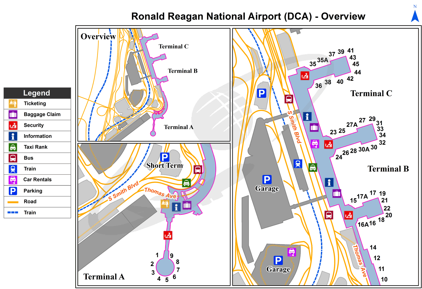
Reagan Airport terminals map
[tp_direct_flights_shortcodes origin=DCA title=»» limit=10 paginate=true subid=»» currency=»USD»]
Current local time in Arlington, United States
")
 International")