Milwaukee Mitchell International Airport (MKE)
General information Milwaukee Mitchell Airport
Country: United States (USA)
ISO code country: US
City: Milwaukee
Airport name: Milwaukee Mitchell International Airport
Code IATA: MKE
Code ICAO: KMKE
Time zone: -6.0 GMT
Altitude: 222 meters
Length of runway: 3045 meters
Fast navigation
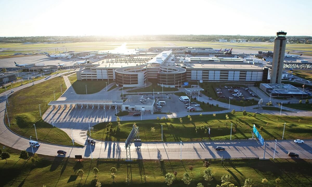
Photo Milwaukee Mitchell airport


Milwaukee Mitchell airport contacts: adress, zip code, phone
Tel: +1 414-747-5300
Adress: 5300 S Howell Ave, Milwaukee, WI 53207, USA
Web: www.mitchellairport.com
Milwaukee Mitchell (MKE) airport on map — location
General info about Milwaukee Mitchell Airport
Milwaukee Mitchell International Airport (MKE) is a civil-military airport 5 nautical miles south of downtown Milwaukee, Wisconsin, United States. The airport covers 2,180 acres (880 ha) and has five asphalt and concrete runways.
Milwaukee Mitchell International Airport is named in honor of United States Army General Billy Mitchell, who was raised in Milwaukee and is often regarded as the father of the United States Air Force. Along with being the primary airport for Milwaukee, Mitchell International is also used by travelers throughout Southern and Eastern Wisconsin and Northern Illinois.
Since March 1941, the airport’s weather station has been used as the official point for Milwaukee weather observations and records by the National Weather Service, whose area office is located in Sullivan.
Video Milwaukee Mitchell Airport
3D tour of Milwaukee Mitchell (MKE) Airport
Airports near Milwaukee Mitchell Airport
Kenosha Regional Airport (24km)
Chicago Executive Airport (58km)
Chicago O’Hare International Airport (67km)
Dane County Regional Truax Field (74km)
Dupage Airport (74km)
Airlines which fly to Milwaukee Mitchell Airport
Airlines alliances at Milwaukee Mitchell Airport
- SkyTeam
- OneWorld
- Star Alliance
MKE Airport Weather
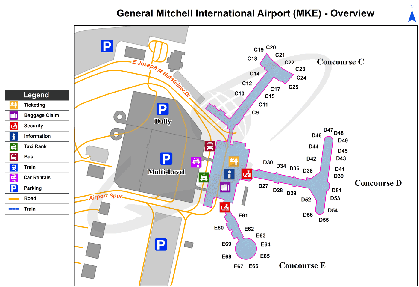
Milwaukee Mitchell Airport terminals map
Current local time in Milwaukee, United States
")
")
")