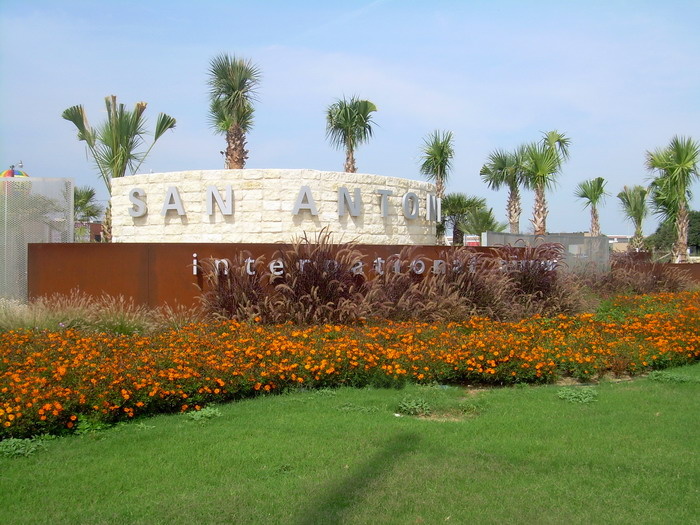
San Antonio International Airport (SAT)
General information San Antonio International Airport
Country: United States (USA)
ISO code country: US
City: San Antonio
Airport name: San Antonio International Airport
Code IATA: SAT
Code ICAO: KSAT
Time zone: -6.0 GMT
Altitude: 247 meters
Length of runway: 2591 meters
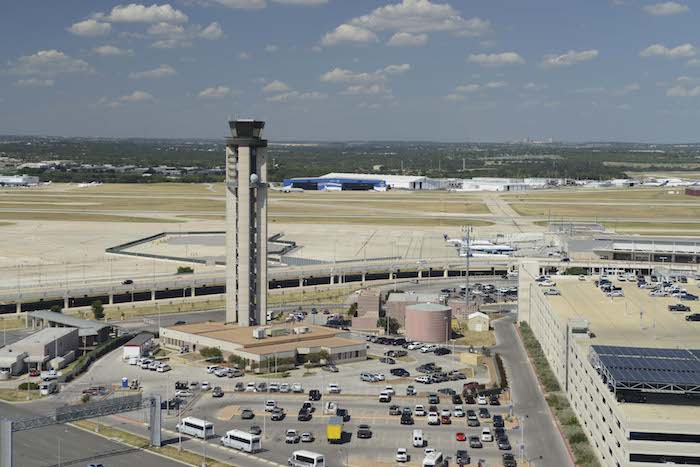
Photo San Antonio airport

San Antonio airport contacts: adress, zip code, phone
Tel: +1 210-207-3433
Adress: 9800 Airport Blvd, San Antonio, TX 78216, USA
Web: http://www.sanantonio.gov/sat
San Antonio (SAT) airport on map — location
San Antonio Airport (SAT)
San Antonio Airport is located in the United States and serves the city of San Antonio. The airport is located 11 km from the city center. It has three runways and covers 2,305 acres (933 ha). Its altitude is 809 feet (247 m) above sea level.
Airlines
A total of 37 airlines depart from SAT airport. USA Southwest Airlines serves the most destinations, flying to 14 airports from here, which is 5 percent of all routes departing from the airport.
Other airlines flying out of San Antonio Airport are: American Airlines, Continental Airlines, Delta Airlines, Frontier Airlines, Gulf Air, KLM, Lufthansa, Mexicana, Northwest Airlines, United Airlines.
From the SAT 29 other airports in various countries are also served. The main destination is Houston.
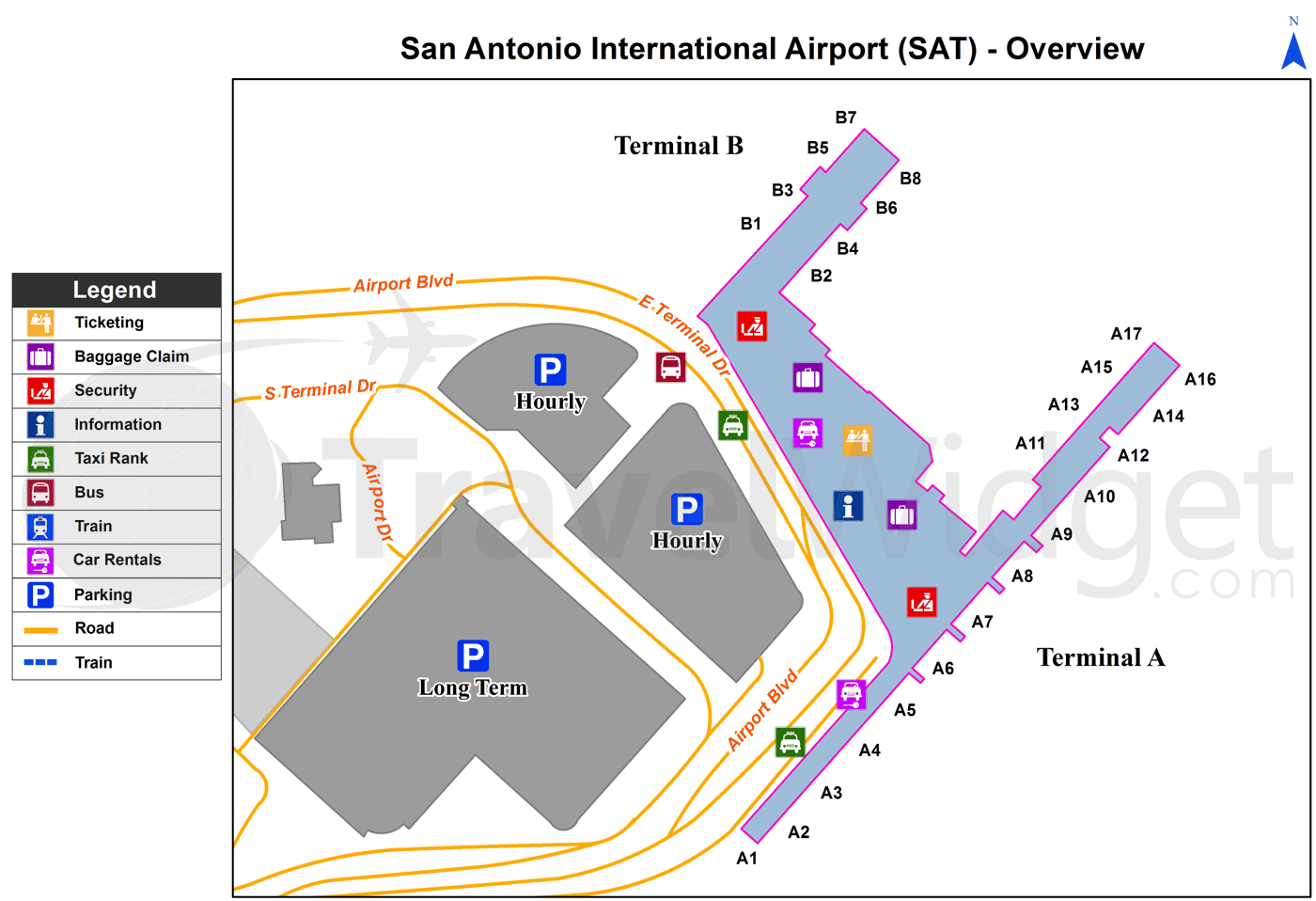
Airport Terminals
San Antonio International Airport has two terminals with a total of 24 gates with aircraft access walkways.
The information desks at the San Antonio International Airport are located in the baggage claim area of Terminal A and Terminal B.
Terminal A
Terminal A (previously Terminal — is the larger of the two terminals with a total of 17 gates. Most airlines serve the San Antonio Texas Airport through this terminal. Along with domestic carriers, all international carriers operate from Terminal A. The most visible improvements for passengers are new terrazzo flooring, new fast food areas and new signage. Currently 8 airlines operate from Terminal A, using 15 of the 17 gates.
Arrivals area — you will find customs and immigration, as well as baggage claim, check-in counters and the airlines’ baggage offices.
Departures area — check-in counters and security control. Terminal A and Terminal B facilities are slightly separated from each other.
Services: Restaurants, cafeterias and stores.
There is also a federal inspection facility on this level, which opened in 2017. Monitors with information are located in the security area. These are located in the boarding area, before check-in.
Terminal B
On November 9, 2010, SAT airport announced the opening of the new Terminal B, which contains 8 gates (B1-B8). Corgan Associates, Inc. and 3D/International designed the new terminal.4 American Airlines and Continental Airlines were the two original operators when the terminal opened. United Airlines at the time was located in Terminal A. Once the merger between United Airlines and Continental Airlines was completed, the new United consolidated all operations in Terminal B. (on August 1, 2012) The Terminal is also home to a United Club lounge located between gates B3 and B5. American Airlines and United Airlines along with their regional affiliates are the sole tenants of the Terminal. All gates in Terminal B are currently in use. The airport’s USO is located on the lower level of Terminal B, next to baggage claim.
Arrivals area — you will find the baggage claim area, information desks, the USO lounge, and baggage offices.
Services: Restaurants, cafeterias and stores, USO.
Departures area — the check-in counter and security checkpoint for Terminal B, as well as boarding gates B1 to B8.
Services: Restaurants, cafeterias, and stores, United Club.
Moving between terminals
Moving from one terminal to the other is easy, as Terminal A and Terminal B are located in the same building.
Accessibility Facilities
Both airport terminals of San Antonio are wheelchair accessible. There are elevators, wheelchair ramps, and automatic doors. Handicap-accessible restrooms are available in both terminals. Special TTY telephones for the disabled are available. Free parking for the disabled is available at all parking lots.
Video San Antonio Airport
Airports near San Antonio (SAT) Airport
San Antonio Martindale AAF airport (13km)
San Antonio Randolph AFB airport (13km)
San Antonio Kelly AFB airport (13km)
San Antonio Stinson Municipal airport (22km)
Austin-Bergstrom airport (107km)
Airlines which fly to SAT Airport
Airlines alliances at San Antonio Airport
- SkyTeam
- OneWorld
- Star Alliance
SAT Airport Weather
San Antonio Airport terminals map
[tp_direct_flights_shortcodes origin=SAT title=»» limit=10 paginate=true subid=»» currency=»USD»]
Current local time in San Antonio, United States
")
")
")